How Aerial Vantage’s Uncrewed Drone Services Save Money and Extract Value for Your Farm
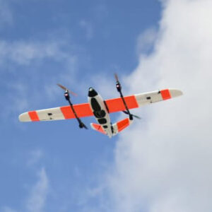
Aerial Vantage continues to forge the way towards large-scale drone operations to provide aerial imagery and enhanced agriculture information to the industry at large. Agriculture organizations performing large-scale operations can now benefit from Aerial Vantage’s unique designation to fly uncrewed drone missions at higher altitudes and longer distances. Currently, many agriculture companies are relying on using crewed aircraft (GA) to gather insights on crops and livestock, an effort that is very cost prohibitive and requires more time spent planning as well as more resources.
Aerial Vantage’s FAA-granted BVLOS waiver has enabled us to perform large-scale operations for customers, which has brought many benefits. Flying uncrewed drones over crewed aircraft has resulted in significant cost savings, reduced risk, and more flexibility for agriculture firms looking to invest in agriculture market intelligence.
Aerial Vantage is leading the agriculture industry toward advanced, large-scale imagery collection. Our work has already been proven via strategic partners, collecting valuable data from hundreds of acres in short amounts of time. Our cutting-edge drone data analytics wield the power of artificial intelligence and machine learning to deliver high-resolution, detailed aerial imagery with techniques like computer vision. This data is compiled, processed, and presented in our user-friendly platform, Accelerate. This drone data management software allows for real-time, continuous updates on drone-acquired aerial data, and is customizable to showcase insights that tie to your firm’s mission and goals.